Carrera del Darro: Granada's Medieval Street Explained
Carrera del Darro history: 11th-century Moorish bridges, El Bañuelo bathhouse, a 1539 Renaissance palace, and Granada's only open stretch of the Darro river.
Seven years resident in Granada. Specialist in Nasrid architecture, Al-Andalus history, and Andalusian walking routes.
Updated Published
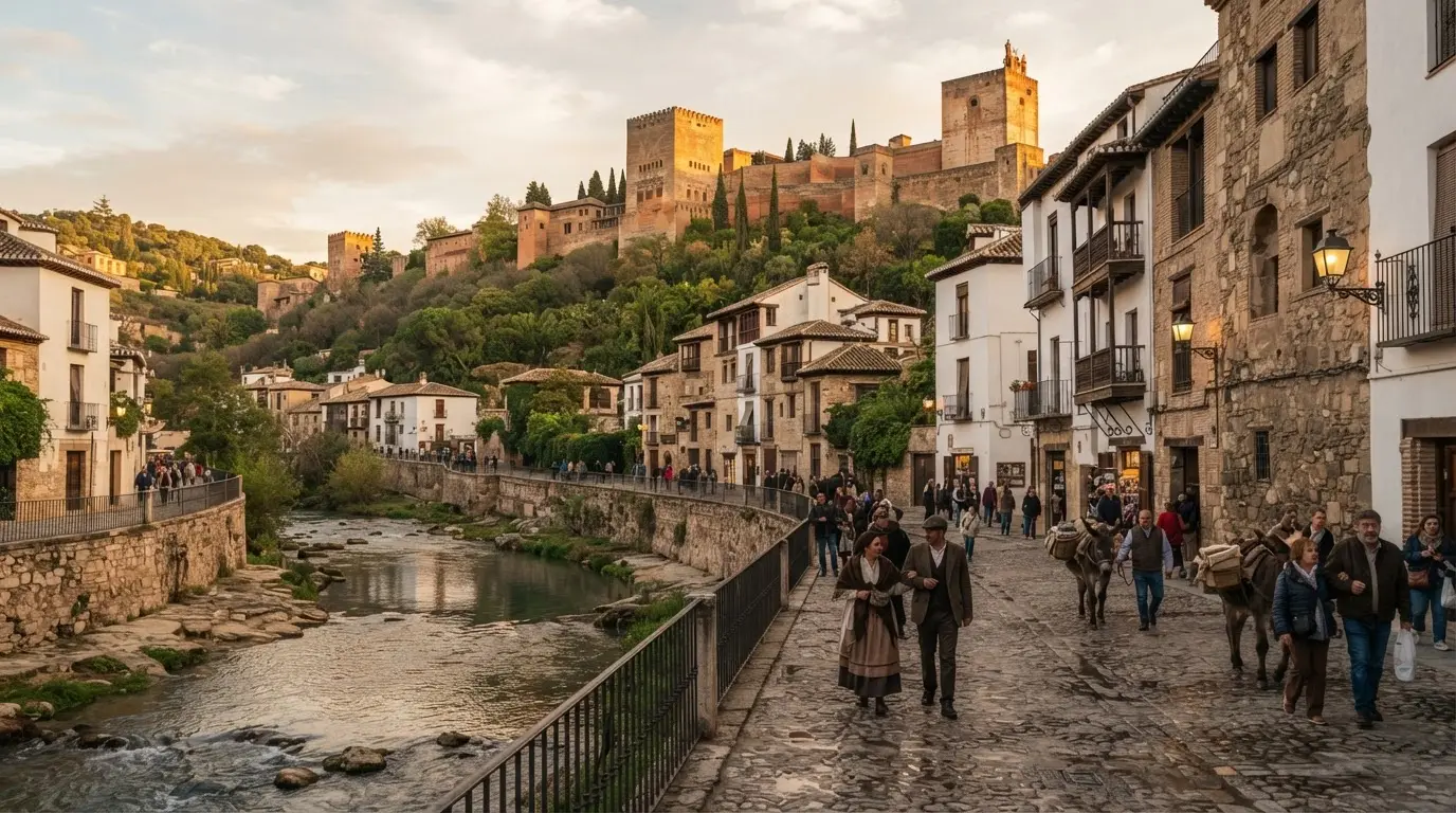
The Carrera del Darro is the only place in Granada where you can stand beside the Río Darro as it runs in open air. Everywhere else in the city, the river flows underground, channelled in a burial that took four centuries and ended in 1938. The ~500-metre stretch between Plaza Nueva and the Casa de las Chirimías survives as a living cross-section of the city's history: Roman gold legend, 11th-century Moorish bridges, a 16th-century Plateresque palace, and the Alhambra towers rising above the far bank.
In this article
Jump to a section
⌄
The river of gold: etymology and Roman origins
The name Darro has travelled a long way to reach English. Its root is the Latin aurum (gold), which the Romans worked into the river's Arabic designation Hadarro, which simplified over centuries of Castilian use to Dauro and finally Darro.[1] The name was not figurative. Between the 1st and 5th centuries CE, Roman miners systematically extracted gold from the river gravels using a technique called ruina montium (mountain ruin): engineers first diverted streams to saturate the rock above the ore deposit, then cut supporting pillars to collapse the saturated mass, releasing tonnes of rock and gravel that could be sluiced for the precious metal.
The alluvial gold in the Darro's gravels and its tributaries draining the Sierra Nevada made the operation economically significant.[2] Granada occupied the Vega below because the river crossing was there; the Roman name for the settlement, Iliberis, long predates the gold-mining phase. But the Darro was the reason the Romans came back, generation after generation, to work the valley.
By the 8th century, when Arab armies completed their conquest of the peninsula, the gold deposits were largely exhausted. The river retained its Roman name, reinterpreted through Arabic phonology, and retained its role as the spine of the city that would grow on the hills above it. When Zawi ibn Ziri of the Berber ruling family moved the city's administrative capital to the Albaicín hill in 1013, he was choosing a site already defined by the Darro gorge on its southern flank.
Muhammad I and the Acequia Real: the river diverted uphill
The defining hydraulic event in the Darro's history came not from the Romans but from the first Nasrid sultan. In 1238, Muhammad I, founder of the Nasrid dynasty and builder of the first Alhambra structures, faced an engineering problem. His new palace complex occupied the Sabika hill across the gorge from the Albaicín, 750 metres above sea level and hundreds of metres above the nearest water source. The Darro ran in the gorge far below.
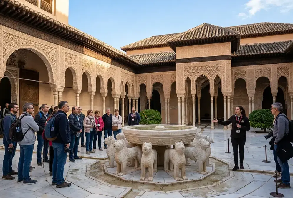
His engineers solved it by constructing the Acequia Real (Royal Channel): a gravity-fed stone aqueduct that diverted water from the Darro approximately 6 kilometres upstream, at a point where the river ran higher up the valley, and conducted it along the hillside contour to the Alhambra at the same elevation.[3] The channel drops imperceptibly over its full length, delivering water at sufficient volume and pressure to supply the entire palace complex, its gardens, and the fountains of the Court of the Lions without any pumping. The Alhambra's water system remains in operation today.
The Acequia Real changed the Darro's relationship to the city. The river still ran through the gorge, but its upper flow was now partially redirected to serve the palace on the hill. The water that reached the Carrera del Darro below was what remained after the Alhambra's allocation: a more modest flow than before, running through a narrower gorge that was, by the 14th century, increasingly built up on both banks.
Three bridges cross the Darro along the Carrera del Darro, and they span nearly nine hundred years of construction. They are the most legible architectural history on the street because you can read their dates in the stonework without needing to enter a building.
The oldest is the Puente del Cadí, also called the Puerta de los Tableros. Built in the 11th century during the Zirid period, it carried a covered passage connecting the Alhambra hill to the Albaicín, a physical link between the palace district and the urban quarter that was closed when the Nasrids took power and the Alhambra became a restricted royal compound.[4] What survives today is the horseshoe arch of the bridge span and the ruined base of a hexagonal tower that formed part of the original gate structure. The dressed stone of the pier is distinctly Moorish: tight-cut ashlar, no mortar joints visible at the arch intrados. Stand below it from the river bank and you can see where the stones were cut to carry the weight of a fortified gate passage above the arch crown.
The other two bridges are early modern:
Recommended tours
Tours are selected for quality, not commission. We earn a small fee if you book — at no extra cost to you.
Puente Cabrera, built in the early 17th century, is the most used crossing on the street: a plain semicircular arch without ornamentation
Puente Espinosa, from the early 17th century, sits slightly downstream and carries a similar profile
11th century
The Puente del Cadí is Granada's oldest surviving bridge, built during the Zirid taifa period. Its horseshoe arch and ruined gate tower predate the Alhambra by more than two centuries.
All three bridges are functional crossings, used daily by pedestrians and cyclists. That continuity of use across nine centuries is part of what makes the Carrera del Darro unusual: this is not a museum street but a working one, where medieval stonework carries modern foot traffic.
The buildings along the street
The Carrera del Darro runs for roughly 500 metres, and within that distance it concentrates more dateable medieval and Renaissance architecture than any other street in Granada. The buildings do not announce themselves. You need to look up from the pavement.
El Bañuelo at number 31 is the oldest inhabited structure on the route. It is a hammam built in the 11th century under the Zirids and one of the best-preserved examples in the Iberian Peninsula.[5] Entry is free. The interior is low-vaulted brick, the ceiling perforated with star-shaped skylights cut for ventilation and light. In the morning, when direct sun enters through the stars, the columns below cast moving shadows. Allow 20 minutes, not the five that most people give it.
A few doors further along Carrera del Darro, the Maristán hospital of Granada — the first Islamic hospital on the Iberian Peninsula, built between 1365 and 1367 by Nasrid sultan Muhammad V — is the newest-old building on the street. Almost entirely demolished in 1843 and forgotten for nearly two centuries, its surviving southern gallery and therapeutic pool foundations reopened to visitors in January 2023 after a 1.3 million euro EU-funded restoration.
Casa de Castril at number 43 is a 1539 palace commissioned by Hernando de Zafra's descendants, with a Plateresque portal attributed to Sebastián de Alcántara, a disciple of Diego de Siloé who shaped Granada's Renaissance architectural tradition.[6] The portal carving above the doorway is exceptionally dense: grotesque figures, shells, and coats of arms compressed into a stone frame less than four metres high. Since 1917 it has housed the Archaeological Museum of Granada, which holds pre-Roman, Roman, and Islamic material from the province.[6]
Further along, Casa de Zafra is a 14th-century Nasrid domestic house. It shows how the Nasrid elite actually lived, rather than how sultans lived in formal palace rooms. It now functions as the Albaicín Interpretation Centre. The Casa del Chapiz, a 16th-century Morisco house (the home of a Muslim who had converted to Christianity), became the School of Arab Studies, now part of the CSIC research network. The Church of San Pedro y San Pablo, established as a parish in 1501 and built in its current form between 1559 and 1567 by architect Juan de Maeda in Mudéjar and Renaissance styles, holds a work by Pedro de Mena, the 17th-century Granadine sculptor whose carving technique influenced the whole Andalusian school.
The embovedado: how the Darro was buried
The progressive underground burial of the Darro is one of the stranger urban stories in Granada's history. The process began in the 16th century in earnest, driven by floods that periodically damaged the lower city, sanitation problems from a river running through an increasingly dense urban area, and the persistent 19th-century idea that open watercourses through cities were obstacles to modernity. For the full chronology — from the Roman gold-mining origins of the river's name through the 1238 Acequia Real diversion and the three phases of 19th-century culverting — read the Darro River's history.
The flood of 27 June 1835 was the decisive event. The Darro backed up into the lower city with enough force to damage buildings as far upstream as the Paseo de los Tristes; contemporary accounts recorded graves destrozos (severe damage) to structures that had stood since the Nasrid period. Further floods in 1851, 1860, 1884, and 1889 reinforced the case for culverting. The city proceeded in two main phases: 1854 to 1884 for the section from Plaza Nueva to the Castañeda bridge, and 1936 to 1938 for the remaining stretch to the Genil confluence, both documented in Granada municipal records and the local heritage register.[7]
By 1938, the Darro had vanished beneath Granada for all but the 500-metre stretch you can still see from the Carrera del Darro. The embovedado (the culverting) was complete. Plaza Nueva, Granada's oldest Renaissance square, now covers the river entirely; walk across it and you are walking above the Darro, which flows in a brick-vaulted tunnel approximately five metres below the paving.
The Carrera del Darro section survived the embovedado because it was already a heritage street by the early 20th century, and because the Alhambra's UNESCO buffer zone designation in 1984 (with the Albaicín added in 1994) has since given the gorge additional protection. The river here is not a relic. It still runs, fed by the Acequia Real's return flow and natural precipitation, and in winter after sustained rain it runs fast enough to be audible from the street above.
Timeline
16th century
Culverting begins
Initial phases of embovedado in the lower city, driven by sanitation concerns.
27 June 1835
Catastrophic flood
The Darro backs up into the city as far as the Paseo de los Tristes, causing severe damage to buildings and accelerating the case for culverting.
1851–1889
Repeated flood damage
Four more damaging floods in 1851, 1860, 1884, and 1889 sustain political pressure for the embovedado.
1854–1884
Plaza Nueva section culverted
The section from Plaza Nueva to the Castañeda bridge is enclosed underground, creating space for the Gran Vía de Colón above.
1936–1938
Embovedado completed
The final section to the Genil confluence is culverted. The Darro disappears underground along the entire lower city, with the Carrera del Darro stretch the sole remaining open section.
1984 / 1994
UNESCO protection
The Alhambra is inscribed (1984), then the Albaicín added (1994). The Darro gorge falls within the protected buffer zone.
The view and the dual backdrop
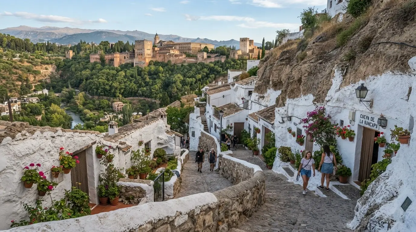
What makes the Carrera del Darro exceptional as an urban experience is the geometry of what you can see from it. The street runs along the gorge floor. On the south bank, the terrain rises almost immediately into the Alhambra's fortified perimeter wall. On the north bank, the Albaicín hill climbs to the Carmen houses and the old Moorish quarter above. You are, in effect, standing between two UNESCO World Heritage Sites simultaneously.
The Alhambra towers visible from the street are the Torre de la Vela, Torre del Cubo, and Torre de Comares, the tallest tower in the Alhambra complex, housing the Throne Room above and the cisterns that fed the palace water system below. From street level at the Carrera del Darro, the Comares Tower appears almost directly overhead, which gives some sense of the Nasrid engineers' achievement: they delivered water to the top of that tower by gravity alone, from a channel intake 6 kilometres upstream.
The Paseo de los Tristes begins where the Carrera del Darro ends, at the Casa de las Chirimías. The Paseo sits slightly wider and more open than the Carrera, and the café terraces there face the Alhambra cliff directly. Both the Carrera and the Paseo are part of the same riverside corridor, but they have different characters: the Carrera is a working street moving between buildings; the Paseo is a promenade stopping to look up. The distinction matters for timing. For the best photography, walk the Carrera before 09:00 when the eastern light is clean on the stonework. Save the Paseo for late afternoon when the Alhambra walls turn amber.
For the full walk logistics, distances, stop durations, and the onward route to the Generalife, the Río Darro Riverside Walk itinerary covers the practical details — one of the free self-guided routes collected on the walking tours page.
Frequently asked questions
What is on the Carrera del Darro in Granada?
The Carrera del Darro (~500m long) contains El Bañuelo (an 11th-century Arab bathhouse at number 31, free entry), Casa de Castril (a 1539 Plateresque palace housing the Archaeological Museum of Granada at number 43), the ruined Puente del Cadí (11th-century Moorish bridge), Puente Cabrera and Puente Espinosa (both early 17th century), and direct views of the Alhambra's Torre de Comares rising above the south bank. Casa de Zafra, Casa del Chapiz, and the Church of San Pedro y San Pablo also line the route.
Why is the Darro called the river of gold?
The name Darro derives from the Latin word aurum (gold) through the Arabic Hadarro. Roman miners worked the river's gold-bearing gravels between the 1st and 5th centuries CE, using a hydraulic technique called ruina montium to collapse and sluice gold-bearing rock. By the time the Nasrids built the Alhambra in the 13th century, the gold deposits were exhausted, but the Roman name had become fixed in the Arabic-speaking population and survived into Castilian Spanish as Darro.
Is the Darro river buried underground in Granada?
Yes. The Darro flows underground through most of the city following a process of progressive culverting (embovedado) between the 16th century and 1938. The decisive trigger was the catastrophic flood of 27 June 1835, which caused severe damage. The main phases were 1854–1884 (Plaza Nueva to Castañeda bridge) and 1936–1938 (to the Genil confluence). The Carrera del Darro is the only place in Granada where the river flows openly above ground.
How long is the Carrera del Darro?
The Carrera del Darro runs approximately 500 metres from Plaza Nueva to the Casa de las Chirimías, where it meets the Paseo de los Tristes (officially Paseo del Padre Manjón). The street is almost completely flat, following the level of the river. Allow 45 minutes to an hour if you stop at El Bañuelo and examine the bridges and palace facades closely.
Who built the bridges on the Carrera del Darro?
Three bridges cross the Darro along the street. The Puente del Cadí (also called Puerta de los Tableros) was built in the 11th century during the Zirid taifa period and was the oldest bridge in Granada before partial collapse. Puente Cabrera and Puente Espinosa both date from the early 17th century. Together they span nine centuries of bridge construction along the same gorge crossing.