Darro River Granada: From Roman Gold to a Buried River
Why does the Darro vanish underground in Granada? The history: Roman gold, the Acequia Real, an 1854 burial, and the one open stretch at Carrera del Darro.
Seven years resident in Granada. Specialist in Nasrid architecture, Al-Andalus history, and Andalusian walking routes.
Updated Published
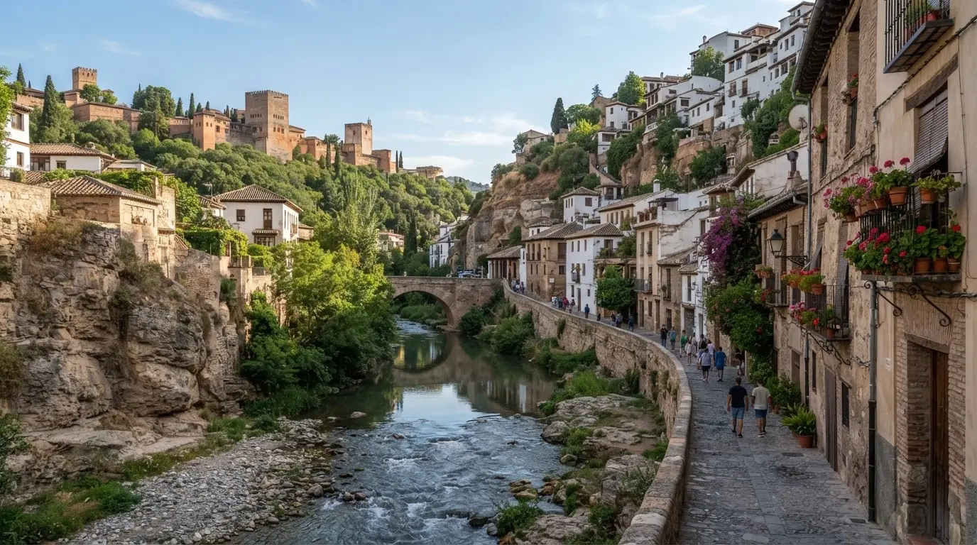
Most visitors to Granada walk above the Darro without knowing it. The river flows under Plaza Nueva, under the Gran Vía de Colón, and under most of the city centre in a bricked vault that has been there since 1938. The open stretch at the Carrera del Darro is the last 500 metres where you can actually see it.
In this article
Jump to a section
⌄
The river of gold: Roman origins and a name that stuck
The name Darro carries its own etymology. It comes from the Latin aurum (gold), refracted through the Arabic Hadarro that Moorish inhabitants used for centuries, then simplified by Christian rulers after 1492 into Dauro and finally Darro.[1] The Romans did not name it poetically. They named it for what they found in it.
From roughly the 1st to the 5th centuries CE, Roman miners worked the Darro's alluvial gold deposits systematically. The technique they used, ruina montium (mountain ruin), involved saturating the hillside rock above an ore deposit with diverted water, then cutting the supporting pillars to collapse the mass. The resulting slurry was sluiced downhill; the gold settled at the bottom of long troughs lined with vegetation that caught the metal. This was not a marginal operation. The Sierra Nevada tributaries draining into the Darro carried enough gold-bearing gravel to sustain multi-generation mining activity across the valley.[2]
By the time the last Roman legions withdrew, the easily extractable gold was gone. The river lost its reason but kept its name. Roman settlers had built villas along the valley terraces, using the Darro gorge as a natural route between the Vega plain and the mountains. The settlement they clustered near, Iliberis, sat on the hill above. It would eventually become Granada, and the valley road below would become the Carrera del Darro.
One thing the Romans left behind, aside from the name: a clear demonstration that the valley had fresh water, arable terraces, and defensible high ground. Whoever controlled the Darro gorge controlled the approach to the city. Every subsequent power in Granada understood this.
Medieval Granada and the river's urban role
When Zawi ibn Ziri of the Zirid dynasty moved Granada's administrative centre to the Albaicín hill in 1013, the Darro became the city's southern boundary.[3] The gorge was both a defensive feature and the main water source for the medina above. Waterwheels (aceñas) lifted the river's flow to irrigation channels serving the Albaicín terraces. Tanneries clustered along the lower banks, where the combination of running water and isolation from residential streets made the noxious work of curing leather practical. Mills ground grain at the points where millraces could be cut.
The river also carried civic infrastructure across it. Bridges were not decorative. The Darro separated the Albaicín hill from the routes south and east, and each crossing point was a controlled entrance to the city or a link between quarters. The Puente del Cadí, built in the 11th century during the Zirid period, carried a covered passage connecting the Albaicín to the hill across the gorge. It was later sealed when the Nasrids tightened access to the Alhambra promontory. A sequence of later crossings served different traffic patterns:
Puente de Cabrera linked the lower Albaicín to routes east of the city
Puente de Espinosa sat slightly downstream, serving the parallel routes
Puente del Aljibillo completed the sequence toward the Genil confluence
By the 13th century, when the Nasrid dynasty took control of Granada, the Darro was already a fully worked river. Mills lined its banks. Tanneries, fulling mills, and small workshops occupied the gorge floor. The medieval city's relationship with the river was entirely practical: it powered things, it supplied things, and it washed things away. What came next was more ambitious.
Ibn al-Ahmar and the Acequia Real: making water climb a hill
In 1238, Ibn al-Ahmar (Muhammad I) founded the Nasrid dynasty and began building on the Sabika hill across the Darro gorge from the Albaicín.[4] The Sabika rose some 150 metres above the valley floor. There was no water on the summit. The Darro ran far below.
His engineers solved this with the Acequia Real (Royal Channel): a gravity-fed stone aqueduct that diverted water from the Darro approximately 6 kilometres upstream, at a point where the river ran at a sufficiently high elevation. The channel followed the contour of the Cerro del Sol hillside, maintaining a gradient of between 2 and 3 per thousand (2–3 per mille) for its entire length.[4] More than half of its route runs in tunnels cut through the hillside itself. The gradient was deliberate and technically precise: steep enough to maintain flow against inevitable silt build-up and friction, shallow enough to prevent erosive velocity. Nasrid hydraulic engineers apparently worked from the principle that the water must walk and not run.
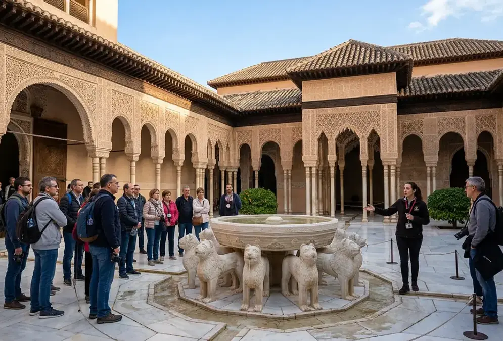
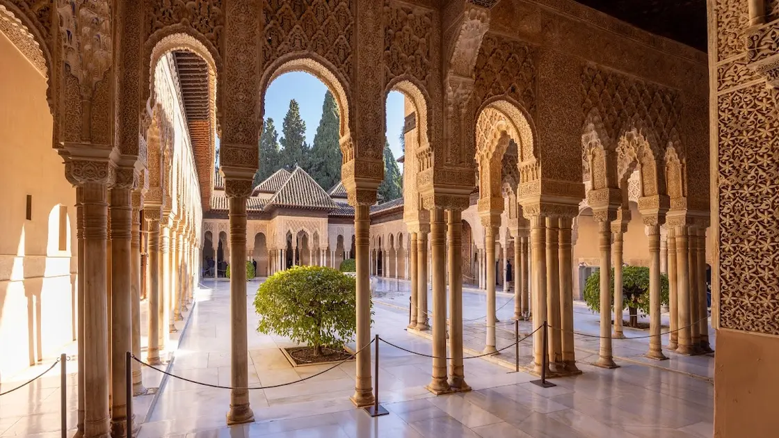
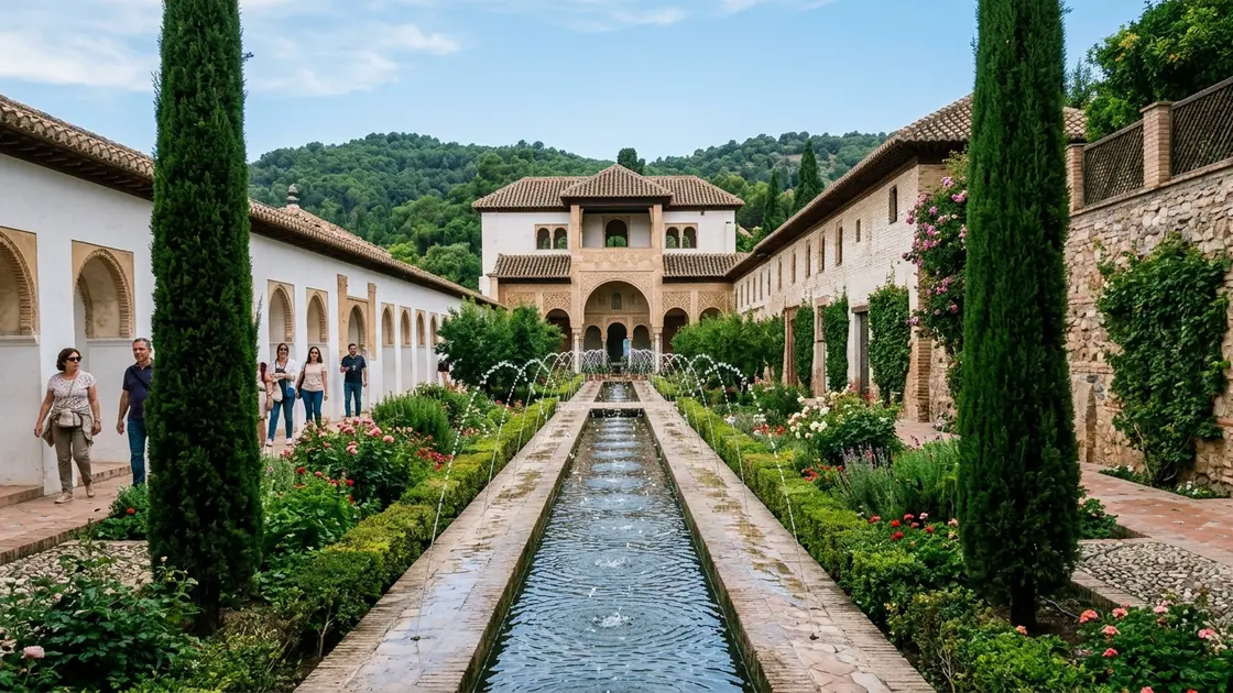
At the Alhambra's upper terrace, the aqueduct fed a central cistern called the Alberca, an elevated reservoir positioned to increase hydrostatic pressure through the height difference between storage and delivery. From the Alberca, distribution channels ran to every part of the palace complex. The Court of the Lions' famous central fountain, the jets in the Patio de la Acequia in the Generalife, the cooling pools of the hammam, the irrigation of the terraced gardens: all fed by gravity alone, from a single intake point 6 kilometres away in the Darro valley.[4]
Recommended tours
Tours are selected for quality, not commission. We earn a small fee if you book — at no extra cost to you.
The Acequia Real is roughly 6 kilometres long and more than half of that is underground.[4] It is still in use. The Alhambra's water system delivers water to the palaces today by the same route as it did in the 13th century, with repairs and modifications but no fundamental alteration to its engineering logic. Walking the Carrera del Darro, you are walking beneath the intake point of a system that has worked continuously for nearly 800 years.
6 km
The Acequia Real runs 6 kilometres from the Darro intake to the Alhambra, with more than half tunnelled through the Cerro del Sol hillside. Its 2–3 per mille gradient keeps water moving at a walking pace without eroding the channel bed.
The Acequia Real also changed the Darro's character at street level. The aqueduct diverted a portion of the river's upper flow to the Alhambra, leaving a reduced volume running through the gorge below. As the Nasrid city grew denser and the valley floor filled with mills, tanneries, and river-dependent workshops, the Darro ran harder-used and lower-banked through an increasingly crowded gorge.
The valley as a heritage corridor: bridges, mills, and water rights
The Darro valley between the Roman period and the 15th century accumulated what heritage authorities now classify as more than 260 distinct heritage aspects: Roman remains, Islamic hydraulic infrastructure, Nasrid bridges, and post-Reconquista modifications layered onto the same narrow gorge.[3] The entire Valle del Darro carries a designation as a Bien de Interés Cultural (Cultural Heritage Site), the highest heritage protection in Spain.
The bridges along the valley illustrate the layering. The Puente del Cadí, built in the Zirid 11th century, used a horseshoe arch characteristic of Andalusian Islamic construction. Later crossings used semicircular arches and heavier piers suited to a river that periodically ran in flood. Five significant bridges cross the Darro between the Alhambra and the Genil confluence, each representing a different moment in the valley's civic life.[5] The four named in the heritage record are:
Puente del Cadí (11th century, Zirid horseshoe arch)
Puente de Cabrera (16th century, semicircular arch)
Puente de Espinosa (post-Reconquista)
Puente del Aljibillo (post-Reconquista)
Water rights in the valley were precisely mapped and fiercely defended. The Acequia Real held absolute priority: the Alhambra's supply came first. Below that, a system of secondary channels distributed water to the Albaicín terraces, to the carmen gardens (the enclosed private garden-houses specific to Granada's hillside topography), and to the industrial users along the gorge floor. Mills paid rent in flour or in cash. Tanneries paid for their allocation. The water was accounted for.
This precision matters for understanding what the 19th-century city inherited. The Darro in 1800 was not a neglected backwater. It was a heavily managed river in a narrow gorge, powering mills, supplying a dense residential quarter, carrying the wastewater of tanneries and fuller's workshops, and flowing through a valley that had been continuously inhabited and modified for at least two thousand years. When the first serious floods struck, the question was not whether the river was useful. It clearly was. The question was whether it could be made safe.
The 1835 flood and the long argument over culverting
On 27 June 1835, the Darro backed up at Plaza Nueva and pushed into the lower city with enough force to inundate the San Pedro neighbourhood and damage buildings that had stood since the Nasrid period.[6] Contemporary accounts described graves destrozos, severe damage, across the lower valley. It was not the first flood, and it would not be the last, but its scale was exceptional and its timing — during a period of liberal urban reform across Spain — gave it political weight.
The first systematic culverting proposals followed immediately. Architect Francisco Contreras drew up what is considered the earliest comprehensive plan for enclosing the Darro through the city centre. The Count of Montijo championed early political backing for the project. The arguments on the other side were not sentimental: culverting would be expensive, technically complex in a gorge built right to the water's edge on both sides, and would eliminate the mills and tanneries that still depended on open-river access.
Further floods in 1851, 1860, 1884, and 1889 each renewed the argument. The city grew denser; the river became more dangerous. The balance shifted with each event.
The definitive decision came under Mayor Mariano Zayas de la Vega, who authorised construction in 1854 with architect Antonio León y Lara directing the first section.[6] The work proceeded from Plaza Nueva eastward, enclosing the river in a brick-vaulted tunnel beneath what would become new street surface. The first major phase ran from 1854 to 1884, enclosing approximately 2 kilometres of the river from Plaza Nueva to the Castañeda bridge. The Gran Vía de Colón was subsequently driven through the newly available land above the tunnel, a broad boulevard in the late 19th-century Haussmann style that obliterated an entire medieval street network in the process.
The logic of the embovedado was urban modernity as it was understood in 1854: a dangerous, unpredictable watercourse converted into controlled infrastructure; a congested gorge opened into a regularised boulevard; sanitation problems solved by removing the open water from the city's surface. The mills and tanneries that had worked the gorge for centuries were gone. The valley had been productive for those industries precisely because it was open; once enclosed, it served a different city.
The embovedado completed, and what the Darro is now
The second and final phase of culverting ran from 1936 to 1938, enclosing the stretch from the Castañeda bridge to the Darro's confluence with the Río Genil.[6] The timing is notable: the work continued through the opening years of the Spanish Civil War, a period when Granada was under Nationalist control. Urban infrastructure projects did not stop. By 1938 the Darro had been underground through the entire city centre for essentially its full urban length.
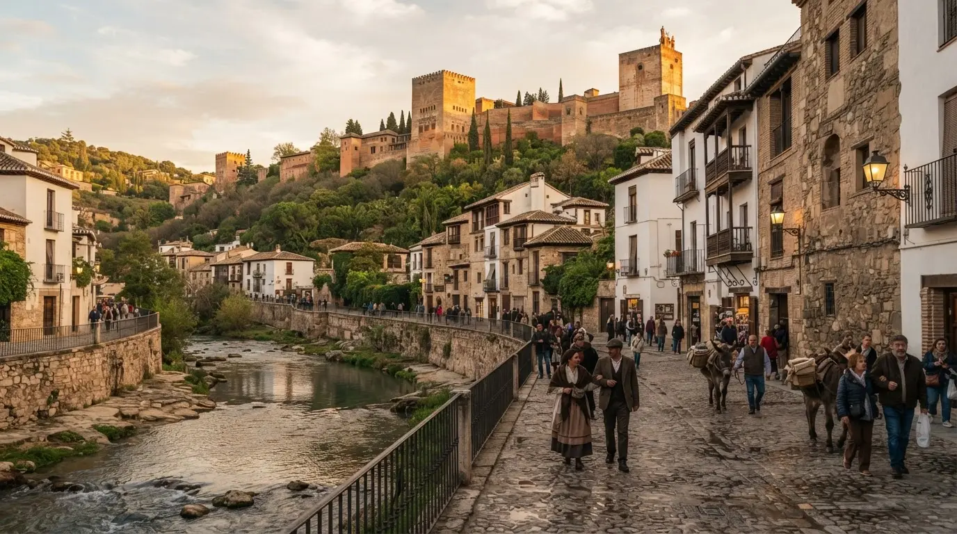
The Carrera del Darro survives as the exception. The 500-metre open stretch between Plaza Nueva and the Casa de las Chirimías was already recognised as a heritage zone by the early 20th century; the proximity of El Bañuelo, Casa de Castril, and the Nasrid bridges made culverting it politically untenable even during the height of the embovedado project. The Alhambra's UNESCO World Heritage inscription in 1984, followed by the Albaicín's addition in 1994, placed the gorge within a protected buffer zone.[3] The open Darro is now formally protected on two counts: the BIC designation for the entire Valle del Darro and the UNESCO buffer zone that extends to both banks.
The river below the Carrera del Darro emerges from underground near the Castañeda bridge and runs openly for a short distance before joining the Genil.[6] Most people visiting Granada never see this lower confluence. The more legible end of the story is the visible one: the Carrera del Darro, where the river runs at the base of a gorge with the Alhambra rising on one side and the Albaicín on the other, linking two UNESCO sites in a single sight line.
For walkers, the Río Darro Riverside Walk traces the full open stretch from Plaza Nueva to the Paseo de los Tristes and beyond, with stop timings and practical logistics. The valley connects two of Europe's most significant medieval urban landscapes, and the river connecting them, for this last half-kilometre, still runs in open air as it did when Roman miners worked its banks eighteen centuries ago.
Timeline
1st–5th century CE
Roman gold mining
Romans extract alluvial gold from the Darro gravels using ruina montium. The river earns the name it still carries: from aurum (gold) via Hadarro.
1013
Zirid dynasty founds Granada
Zawi ibn Ziri moves the administrative centre to the Albaicín hill, making the Darro gorge the city's southern boundary.
1238
Acequia Real constructed
Ibn al-Ahmar diverts the Darro 6 km upstream to supply the Alhambra via a gravity-fed stone aqueduct, still operating today.
27 June 1835
Catastrophic flood
The Darro backs up at Plaza Nueva and inundates the San Pedro neighbourhood. The first comprehensive culverting plans follow within days.
1854–1884
First embovedado phase
Mayor Zayas de la Vega authorises construction. Architect Antonio León y Lara directs the first section. Roughly 2 km culverted from Plaza Nueva to Castañeda bridge.
1936–1938
Embovedado completed
Final section enclosed to the Genil confluence. The Carrera del Darro remains the only open stretch, protected by heritage designations.
1984 / 1994
UNESCO protection
The Alhambra inscribed 1984; the Albaicín added 1994. The Darro gorge falls within the protected buffer zone on both banks.
Frequently asked questions
Where does the Darro river go in Granada?
The Darro flows underground through most of Granada in a bricked vault built between 1854 and 1938. It runs beneath Plaza Nueva and the Gran Vía de Colón before emerging near the Castañeda bridge, then continues openly to join the Río Genil. The only visible stretch in the city centre is the 500 metres at the Carrera del Darro, between Plaza Nueva and the Casa de las Chirimías.
Why is the Darro called the river of gold?
The name derives from the Latin aurum (gold) through the Arabic Hadarro. Roman miners worked the river's gold-bearing gravels between the 1st and 5th centuries CE, using a hydraulic collapse technique called ruina montium. The gold deposits were exhausted before the Islamic period, but the Roman name had become fixed and survived into Castilian Spanish as Dauro and then Darro.
Is the Darro river underground in Granada?
Yes, through most of the city centre. The culverting (embovedado) was carried out in two main phases: 1854–1884 for the Plaza Nueva to Castañeda bridge section, and 1936–1938 for the remainder to the Genil confluence. The decisive trigger was the catastrophic flood of 27 June 1835. The Carrera del Darro is the only place in the city where the river still flows above ground.
How did the Darro supply the Alhambra?
Ibn al-Ahmar built the Acequia Real in 1238, a gravity-fed stone aqueduct that diverted Darro water from 6 kilometres upstream and conducted it along the hillside at a 2–3 per mille gradient to the Alhambra's elevated cistern (the Alberca). From there, water distributed by gravity alone to every courtyard fountain and garden in the complex. The aqueduct is still in operation today.
What is the Valle del Darro and is it protected?
The Valle del Darro is the Darro river valley through Granada, carrying over 260 documented heritage features from Roman times to the present. It holds designation as a Bien de Interés Cultural (BIC), Spain's highest heritage protection category. The gorge also falls within the UNESCO World Heritage buffer zone protecting both the Alhambra (inscribed 1984) and the Albaicín neighbourhood (inscribed 1994).
When was the Darro river buried underground in Granada?
Construction began in 1854 under Mayor Mariano Zayas de la Vega, with architect Antonio León y Lara directing the first section. The first phase (1854–1884) enclosed roughly 2 kilometres from Plaza Nueva to the Castañeda bridge. A second phase (1936–1938) completed the culverting to the Genil confluence. The Carrera del Darro was left open throughout and remains so today.
Can you see the Darro river in Granada today?
Yes, at the Carrera del Darro, the medieval street running from Plaza Nueva to the Casa de las Chirimías. Here the river runs openly at the base of a gorge with Alhambra towers above one bank and the Albaicín hillside above the other. The walk takes about 45 minutes if you stop at El Bañuelo and the Nasrid bridges. The Río Darro Riverside Walk itinerary covers the practical route in detail.