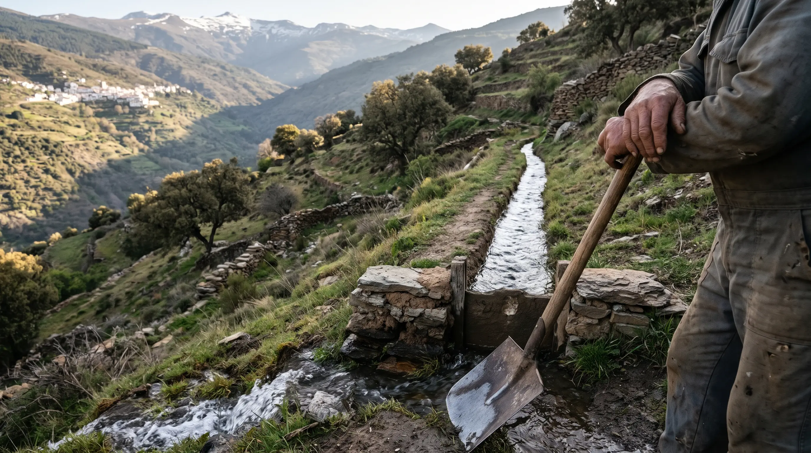
Acequias de careo Sierra Nevada: an unlined snowmelt channel crossing a high schist slope above an Alpujarra valley at dawn, stone sluice gate in the foreground, patches of late snow on the ridge

How Acequias de Careo Bank Sierra Nevada's Snowmelt

Sierra Nevada's acequias de careo send snowmelt into hillside aquifers, a practice about 1,300 years old that still feeds Alpujarra rivers in dry summers.

Portrait of James Walker
Written by

Seven years resident in Granada. Specialist in Nasrid architecture, Al-Andalus history, and Andalusian walking routes.

Published
Early Islamic, Zirid & Almohad711–1238
In a dry summer, up to 58% of the water in the Río Mecina was snow that had melted months earlier, parked in the hillside by a single channel.[1] That channel belongs to the acequias de careo of Sierra Nevada, uncoated ditches that spread meltwater over the slope so the mountain releases it in summer, a practice dated to about 1,300 years ago.[2] More than 750 km of them survive in the range, but they only work where rock, slope and a community with shovels line up.[3]
Age of the practice
1,300 years
Sediment dating points to the Visigoth to al-Andalus transition[2]
Summer Río Mecina flow
58%
Came from one careo channel in the dry 2021-2023 study period[1]
Careo channels in the range
750 km
Many of them still operational today[3]

How snowmelt becomes summer water

A careo channel does one job. It takes meltwater from the headwaters of a mountain stream and walks it sideways across the slope in uncoated ditches dug into the ground, so the water soaks in near the top of the valley instead of racing down it.[4] The best-studied example sits in the Río Bérchules basin, the easternmost tributary of the Guadalfeo in the Alpujarra.[5]
Underground, the water slows to the pace of the rock. An aquifer moves water at about a metre a day, roughly a hundred metres in three months.[6] Locals call the trick entretener el agua, keeping the water occupied until summer, when the mountain needs it.
The delay is the payoff. During the dry 2021-2023 study period, up to 58% of the summer flow in the Río Mecina came from recharge by one careo channel.[1] That water starts as snowpack on the high ridge, the same terrain as the Corral del Veleta glacier, and in effect it is still arriving in August.
The Mecina figure comes from a 2024 paper by Zakaluk and colleagues in the Journal of Hydrology: Regional Studies, which tied the summer flow to one ditch rather than to the whole network.[26] It is a measured result for a single channel in a dry stretch, so read 58% as what a well-sited careo can do, not as an average for the range.

Careo and riego: two kinds of ditch, one calendar

Recharge is what separates a careo from the irrigation ditch running beside it. The water sown into the slope activates numerous springs halfway down the hillside and lifts the base flow of the rivers, while an acequia de riego simply carries water to fields and orchards.[7]
Careo channels are unlined, and some run longer than 10 km.[8] They pay off only where geology and climate cooperate, which the researchers who work on them reduce to four conditions:[9]
  • hard weathered rock such as schist
  • enough slope
  • a long dry season
  • a community that knows the technique and keeps it up
The working year follows the snow. Shortly before the thaw the acequieros clean the channels and open stone sluice gates to begin sowing water; in May or June the careo ditches are cut and the irrigation channels opened.[10] The same sluice gate, in other words, decides whether a drop goes into the hill or onto a terrace.
Timing matters as much as place. The ditches take rain and meltwater from the river headwaters and spread it over the slopes during winter and spring, which is why the cleaning happens before the thaw and not after.[23] Once the gates change roles in May or June, whatever went into the hill is already on its slow way down to the springs.

Dating the system: from Visigoth Spain to al-Andalus

Archaeological and historical research places careos in operation in Sierra Nevada by the 11th century at the latest.[11] The newer evidence is older by several centuries: dating of sediments puts the start of sowing and harvesting water about 1,300 years ago, at the hinge between the end of the Visigoth period and the beginning of al-Andalus.[12]
That puts the careos before the palaces. The Nasrid water engineering described in the Alhambra's water system came centuries later, and it served a palace, not a mountain.
Water sowing is not unique to Spain: documented cases turn up in several regions, with the best-recorded in the high Andes of Peru and Ecuador.[13] Sierra Nevada's claim rests on age and on use, since IGME counts more than 750 km of careo channels, many still operating.[3]
Read the two dates together. The 11th century is when the evidence shows channels at work;[11] 1,300 years is when the sediment says the habit began.[12] The interval between them is roughly three centuries, which is why the sediment dating drew attention. For a channel that carried spring water to a city instead of sowing it into a hillside, see Aynadamar, Granada's Fountain of Tears.

Who keeps the water moving: irrigators, volunteers and UNESCO
A careo is a shared chore before it is a piece of engineering. Irrigators' communities maintain the channels collectively, and that shared upkeep is credited with strengthening social cohesion in the mountain villages.[16] In the Alpujarra's Morisco-era villages, where hamlets and terraces still depend on snowmelt, the person who knows when to open the gate matters as much as the ditch.
The risk is abandonment. The Barjas channel at Cáñar was dropped in the 1990s because hardly any farmers were left, and it was recovered about a decade ago by the University of Granada's MemoLab working with the irrigators' community and volunteers.[17] Restoration has since reached about 100 km of acequias, careo and riego, mostly in Granada but also in Almería and Cáceres.[18]
The people who run the system have job titles of their own. Mountain stock farmers and acequieros, the specialists in catching and allocating water, steer the meltwater so it seeps down through the high part of the valleys.[25] The Barjas channel starts at about 1,800 m, where it feeds on thaw water.[27] Nothing about the technology is exotic: it runs on gravity and local materials, which is why a volunteer crew can bring a dead ditch back to life.[24]
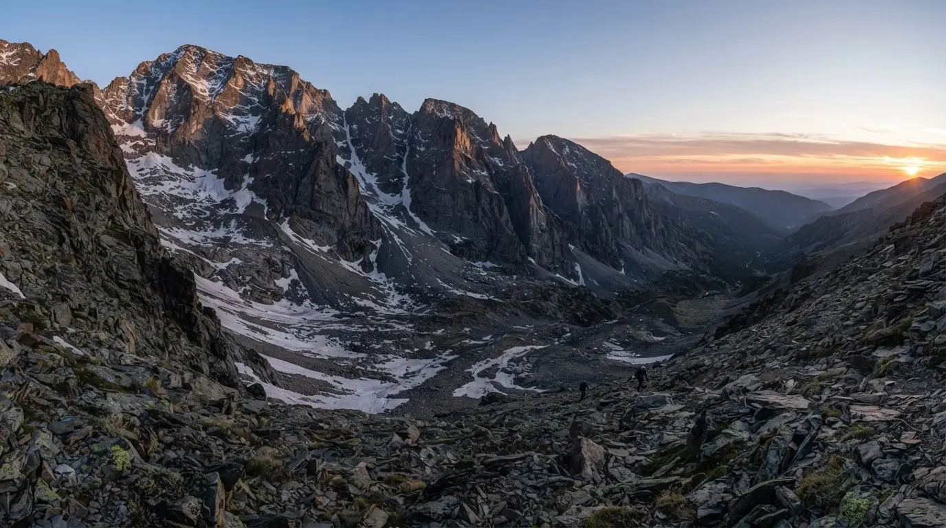
Corral del Veleta cirque in Sierra Nevada at dawn, north-facing rock walls over 300 metres high surrounding the glacial remnant below, snow patches clinging to shadowed scree at 3,100 metres

Deep dive · Article

Corral del Veleta Glacier: Europe's Southernmost Ice

Corral del Veleta held Europe's southernmost glacier — active until 1913 at 37°N. Relict ice and permafrost still cling on in Sierra Nevada, shrinking fast.

UNESCO recognises the careos as Spain's first demonstration site, one of thirty worldwide for ecohydrological water management.[19] The network was recognised in 2023 as a Hydrology Demonstration Site.[28] For a ditch older than the Nasrid dynasty, it is a late but useful credential.

Walking the acequias today

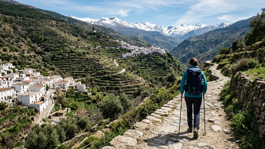
Visitors meet the acequias on foot. A waymarked loop starts and finishes in Capileira, climbs one side of the Poqueira Gorge and returns along the other, passing the water channels on the way.[20] It suits spring and autumn better than midsummer.
Check path status before setting out. The storms of early 2026 seriously damaged paths around Poqueira, and many remain closed for safety.[21]
The research programme behind the dating also produced a booklet of five suggested routes through the massif, built around water, acequias and the people who tend them.[22] A guided option from Granada is the Alpujarras hiking and trekking day trip; ask the guide where water is running that week.
Hiker on a stone path between the white village of Pampaneira and Capileira in the Poqueira gorge, Alpujarras, with terraced hillsides and Sierra Nevada peaks behind

Things to do · Activity

Alpujarras Hiking and Trekking Day Trip

Guided day hike through the Poqueira gorge linking Pampaneira, Bubión and Capileira on ancient Moorish paths. From €45 per person. Spring and autumn are ideal.

Plan around the water calendar. Late spring is when the gates change roles, with the careo ditches cut and the irrigation channels opened for the terraces, so a May walk shows the system at its busiest.[10] Keep to the waymarked path and step across a ditch rather than along its bank: these are working channels that farmers rely on, not heritage props.

Frequently asked questions

What are the acequias de careo in Sierra Nevada?

They are uncoated channels dug into the ground that divert meltwater from mountain headwaters so it soaks into the upper valleys.[4] The water travels slowly underground and re-emerges lower down in springs and rivers.

How do acequias de careo recharge aquifers?

The channels spread meltwater over a slope, where it infiltrates and moves through the aquifer at roughly a metre a day.[6] The recharge then activates springs halfway down the hillside and raises river base flow.[7]

How old are the acequias de careo?

Sediment dating puts the practice at about 1,300 years old, at the shift from the Visigoth period to al-Andalus.[12] Archaeological and historical work shows channels operating by the 11th century.[11]

Are the Sierra Nevada careos the oldest aquifer recharge system in Europe?

A 2019 Journal of Hydrology paper concluded they may be the oldest managed aquifer recharge system in Europe.[15] The wording is deliberately hedged.

What is the difference between an acequia de careo and an acequia de riego?

A careo puts water into the hillside to recharge springs and rivers, while a riego carries it to crops.[7] Careo channels are unlined and some exceed 10 km.[8]

Can you walk along the acequias in the Alpujarra?

Yes. A waymarked loop from Capileira follows the Poqueira Gorge and passes the channels, though many paths there remain closed after the early-2026 storms.[20][21]

Why do Alpujarra rivers keep flowing in summer?

Part of the reason is stored snowmelt: in the Río Mecina, up to 58% of summer flow came from one careo channel during a dry study period.[1]

Sources

28 references Show
  1. info.igme.es (opens in a new tab)

    “se pudo demostrar que hasta un 58 % del agua que discurre por el río Mecina durante el verano se debía a la recarga realizada con una única acequia de careo.”

  2. canal.ugr.es (opens in a new tab)

    “These calculations show that the practices of sowing and harvesting water on Sierra Nevada date back about 1,300 years.”

  3. info.igme.es (opens in a new tab)

    “En Sierra Nevada existen más de 750 km de acequias de careo, muchas de ellas operativas”

  4. docta.ucm.es (opens in a new tab)

    “Meltwater is derived from the headwaters of the mountain streams and rivers through a set of uncoated channels excavated in the ground (locally known as acequias de careo) to infiltrate at the upper part of the valleys.”

  5. canal.ugr.es (opens in a new tab)

    “The study centred on the River Bérchules basin (Granada), which is the easternmost tributary of the River Guadalfeo in the Alpujarra.”

  6. eldiario.es (opens in a new tab)

    “La velocidad media en un acuífero es de un metro al día, unos cien metros en tres meses.”

  7. docta.ucm.es (opens in a new tab)

    “The recharge accomplished through this Managed Aquifer Recharge technique (MAR) activates numerous springs located halfway down the hillside and increases the base flow of the rivers.”

  8. theobjective.com (opens in a new tab)

    “Las acequias de careo son canales excavados en el terreno, sin revestir, algunos con más de 10 km de longitud.”

  9. eldiario.es (opens in a new tab)

    “que haya suficiente pendiente; que se dé un periodo seco largo”

  10. eldiario.es (opens in a new tab)

    “Poco antes del deshielo se limpian las acequias y se abren las compuertas de piedra para empezar a sembrar agua”

  11. canal.ugr.es (opens in a new tab)

    “there were acequias de careo operating in Sierra Nevada as early as the 11th Century.”

  12. canal.ugr.es (opens in a new tab)

    “That means this system was first implemented during the transition period between the end of the Visigoth period and the beginning of the period associated with al-Andalus.”

  13. canal.ugr.es (opens in a new tab)

    “although the most-documented cases are found in the high-Andean regions of Peru and Ecuador.”

  14. canal.ugr.es (opens in a new tab)

    “This finding is the outcome of various research techniques conducted by experts from different fields including archaeology, sedimentology, geophysics, and hydrogeology.”

  15. docta.ucm.es (opens in a new tab)

    “Results suggest that the acequias de careo may be the oldest MAR system in Europe”

  16. theobjective.com (opens in a new tab)

    “su mantenimiento colectivo, realizado por las comunidades de regantes, contribuye a aumentar la cohesión social”

  17. eldiario.es (opens in a new tab)

    “Se abandonó en los años 90 porque apenas quedaban agricultores en la zona”

  18. eldiario.es (opens in a new tab)

    “Hasta la fecha han restaurado cien kilómetros de acequias, de careo y de riego, fundamentalmente en Granada, pero también en Almería y Cáceres.”

  19. theobjective.com (opens in a new tab)

    “el primer sitio demostrativo de España y uno de los treinta a escala mundial”

  20. treksierranevada.com (opens in a new tab)

    “Starting and finishing in the picturesque village of Capileira, this walk takes you up one side of the Poqueira Gorge, and back down the other side.”

  21. treksierranevada.com (opens in a new tab)

    “A series of storms in early 2026 caused serious damage to paths in this area, and many remain closed for safety reasons.”

  22. canal.ugr.es (opens in a new tab)

    “Five fascinating routes through the massif are also suggested, in which water, acequias, Sierra Nevada, and its people are the main protagonists.”

  23. info.igme.es (opens in a new tab)

    “Las acequias de careo son canales excavados en la tierra que derivan agua de lluvia y deshielo de las cabeceras de los ríos para infiltrarla en las laderas durante el invierno y la primavera.”

  24. info.igme.es (opens in a new tab)

    “con una tecnología verde, que funciona con la fuerza de la gravedad y con materiales locales.”

  25. canal.ugr.es (opens in a new tab)

    “are used by mountain stock farmers and acequieros (the individuals with expert skills in water catchment and allocation) to channel the meltwater so that it seeps down through the high part of the valleys.”

  26. info.igme.es (opens in a new tab)

    “Journal of Hydrology: Regional Studies 54, 101870. DOI: 10.1016/j.ejrh.2024.101870”

  27. eldiario.es (opens in a new tab)

    “Empieza a unos 1.800 metros de altitud, donde se nutre de las aguas del deshielo”

  28. eldiario.es (opens in a new tab)

    “En 2023, la red de acequias fue reconocida por la Unesco como Sitio Demostrativo de Hidrología”